|
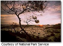
 More than 80 percent of Gulf Islands National Seashore is under water, but the barrier islands are the most outstanding features to those who visit. The Seashore stretches 160 miles from Cat Island in Mississippi to the eastern tip of Santa Rosa Island in Florida. There are snowy-white beaches, sparkling blue waters, fertile coastal marshes, and dense maritime forests. Visitors can explore 19th century forts, enjoy shaded picnic areas, hike on winding nature trails, and camp in comfortable campgrounds. In addition, Horn and Petit Bois Islands located in Mississippi are federally designated wilderness areas. Nature, history, and recreational opportunities abound in this national treasure. More than 80 percent of Gulf Islands National Seashore is under water, but the barrier islands are the most outstanding features to those who visit. The Seashore stretches 160 miles from Cat Island in Mississippi to the eastern tip of Santa Rosa Island in Florida. There are snowy-white beaches, sparkling blue waters, fertile coastal marshes, and dense maritime forests. Visitors can explore 19th century forts, enjoy shaded picnic areas, hike on winding nature trails, and camp in comfortable campgrounds. In addition, Horn and Petit Bois Islands located in Mississippi are federally designated wilderness areas. Nature, history, and recreational opportunities abound in this national treasure.
Whether you visit the seashore for a day or a week there are numerous activities and places to explore. Activities include swimming, bike riding, snorkeling, fishing, hiking, beach combing, wildlife watching, boating, and camping. Visitors are also encouraged to relax and watch a sunset.
Visitor Centers are located at Naval Live Oaks, at Fort Pickens, and at Fort Barrancas. There are trails including sections of the
Florida National Scenic
Trail, the 40-mile loop multi-use trail, a 2-mile bike path, and a fishing pier. Pavilions, boardwalks, a museum, historic fortifications, and campgrounds are located on Santa Rosa Island. On board Naval Air Station Pensacola, visitors can tour Fort Barrancas, the Advanced Redoubt, and hike two trails. Ranger-led tours of Fort Pickens or Fort Barrancas are given daily.
Fees:
Motorcycle, Bicycle, Walk-in - $3 per person (Good for 7 days)
Vehicle - $8 (Good for 7 days)
Gulf Islands Annual Pass - $25
Night Owl Pass (after hours access) - $30
Getting There:
To get to Naval Live Oaks, Fort Pickens and Santa Rosa areas take U.S. 98 east from Pensacola, Florida. The Naval Live Oaks area is just east of Gulf Breeze on U.S. 98. To reach Fort Pickens and Santa Rosa, take Florida Route 399 from Gulf Breeze across the toll bridge to Pensacola Beach. From there, Fort Pickens is nine miles west, and the Santa Rosa area is 10 miles east. The Okaloosa Area is on U.S. 98 east of Fort Walton Beach. To reach the mainland forts on board Pensacola Naval Air Station use Blue Angle Parkway (Florida Route 173). Florida Route 292 leads southwest from Pensacola to Perdido Key Area. On the island turn left onto Johnson Beach Road.
|


