

|

|
|
|
 |
| Description
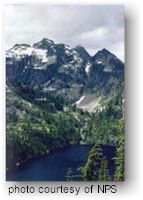
Ross Lake National Recreation Area is part of the North Cascades National Park Service Complex. Ringed by mountains, it offers many outdoor recreation opportunities along the upper reaches of the Skagit River, between the north and south units of North Cascades National Park. |
|||||||||||||||||||||||||||||||||||||||||||||||||||||||||||||||||||||||||||||||||||||||||||||||||||||||||||||||||||||||||||||||||||||||||||||||||||||||||||||||||||||||||||||||||||||||||||||||||||||||||||||||||||||||||||||||||||||||||||||||||||||||||||||||||||
|
Thirty miles of State Route 20 access upper area of the
Skagit Rive Watershed offering many of the region's best camping, hiking
and boating opportunities. The free-flowing section of the Skagit River
below Newhalem provides excellent rafting and wildlife observation. A raft
launch is located adjacent to Goodell Creek Campground near the picnic
shelter. Careful planning is necessary to float the swift Skagit River.
Three reservoirs provide power for Seattle City Light and recreational activities for visitors. The three dams vary in height: Gorge - 300 feet, Diablo - 389 feet, and Ross - 540 feet, with corresponding differences in lake size. Gorge Creek Falls area, 3.5 miles east of Newhalem, has improved facilities with a new accessible interpretive loop trail with views of Gorge Dam. Diablo Lake is the central jewel of the three lakes, offering the best accessibility. It is open all year to fishing and boating; a boat launch is available at Colonial Creek Campground. There are three boat-in sites along the shore of Diablo Lake, which require a free backcountry permit. Thunder Creek, the major tributary to the lake, carries the fine glacial sediment which gives the lake its brilliant turquoise color. A 28 mile hiking route through the park into the Stehekin Valley follows Thunder Creek to Park Creek Pass. Ross Lake is the largest of three reservoirs created by the impounded waters of the upper Skagit River. Ross Lake winds nearly 25 miles from the dam north to the Canadian border at Hozomeen. During the summer, vehicle access and boat launching are possible from the north by traveling the 40-mile gravel Silver-Skagit Road south of Hope, British Columbia. Hozomeen Campground is primitive with water and vault toilets. It is necessary to pack out all garbage. Access to Ross Dam and Lake from the south is limited to trail and water routes. Diablo Lake, Ross Dam, and East Bank trails provide access for hikers from trailheads off State Route 20. Ross Lake Resort, (206) 386-4437, has cabins, small rental boats, and provides portage past the dam and water-taxi service to trailheads and remote backcountry campsites, which require free permits. Ross Lake has a quality sport fishery of naturally reproducing trout that opens for fishing July 1 each year. The catch limit is three rainbow trout (13 inch minimum) per day. No bait or barbed hooks are allowed. If Dolly Varden or bull trout are hooked, they must be carefully and immediately released. Ross Lake's natural spawning occurs in the Skagit River above the lake and in the tributary streams like Big Beaver, Lightning, Roland, Dry, and Ruby Creeks. All of Ruby Creek and 1/4 mile upstream from the mouth of Big Beaver are closed to fishing. All other tributaries are closed for one mile upstream. A Washington State fishing license is required. Ross Lake's limited access helps protect the pristine quality of the lake and its environment.
There are 19 boat-access camp areas on Ross Lake and 3 on Diablo Lake. A backcountry permit is required for any overnight camping. All Ross Lake campsites are equipped with fire-rings, picnic tables, and vault toilets. The Hozomeen campground is also accessible by car from Hope, British Columbia. The following are Boat and/or Hiking/Horse Access Only (except for Hozomeen).
Green Point Campground has
access to Big Beaver Trail. Ross Lake water level is generally full from late June through mid-September. Some sites may be inaccessible during low water conditions. During other months of the year, drawdowns of the reservoir expose rocks, snags and other underwater hazards. Watch out for floating logs, debris, shallows or submerged obstacles at all times.
|
|||||||||||||||||||||||||||||||||||||||||||||||||||||||||||||||||||||||||||||||||||||||||||||||||||||||||||||||||||||||||||||||||||||||||||||||||||||||||||||||||||||||||||||||||||||||||||||||||||||||||||||||||||||||||||||||||||||||||||||||||||||||||||||||||||
|
For Additional Information Contact: Ross Lake National
Recreation Area
For more information visit the National Park Service website |